The Plat books are extremely helpful when doing genealogy research. Beyond finding the location they lived, you often can glean many family connections. The maps are reference material to be used at the Iowa County Historical Society.
| 1860 | 1870 | 1895 | 1915 | 1952 | 1956 |
| 1962 | 1965 | 1968 | 1973 | 1976 | 1982 |
| 1990 | 1992 | 1993 | 1996 | 1999 | |
| 2002 | 2016 | 2017 | 2021 | 2023 |
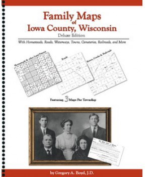
Family Maps of Iowa County, Wisconsin, by Gregory A. Boyd.
This 370 pages book is packed with 86 maps. Boyd had organized the information gleaned from the U.S. Bureau of Land Management on the original Land Patents. Each township has three two-page maps. The primary map shows the original landowners (patent maps). Another shows a road map, and the third map shows the waterways, railroads, and cemeteries.